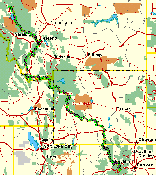
For the visually oriented among you, here's some eye candy.
This is a satellite's-eye view of the "Great Divide Mountain Bike Trail" from Whitefish, MT to Silverthorne, CO. The trail goes on to the Mexican border, but I figure I'll leave that part 'til next year. :-)
Click anywhere on the route and you'll be whisked away to the land of the big sky. OK, maybe you'll just see a closer-up view of the terrain through which I'll be riding. Of course, this is just my projected route. I reserve the right to take any detours for convenience or whim. I'll keep you posted.
** Some people have asked me if the green circles signify anything. Ideally, they would show where I was planning to spend the night -- but they don't. Basically, I had to put many more waypoints (the green dots) down, because the software doesn't save the route until each waypoint. Also, (rather inconveniently) the program would crash after about 20 shape points (bends in the line). So I just started putting in a lot of waypoints to keep the program from crashing. I intend to put some other color dots on the map where I actually spend each nite.